There are 3 high school codes in Saint Vincent and the Grenadines today, according to the ACT. The full list is shown below by city, with name of each high school and the city where the school is located (based on the ACT official site). You can search a school code by pressing “Ctrl” + “F” and then type school name or 6-digit school code.
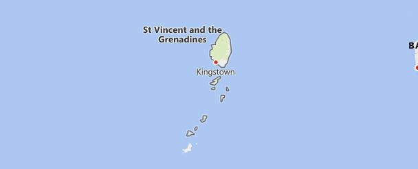
Map of Saint Vincent and the Grenadines
High School Codes by City
- High School Code
- 890260
- High School Code
- 890295
- High School Code
- 890300
The above lists CEEB codes (College Entrance Examination Board) for all accredited Saint Vincent and the Grenadines high schools. Please be informed that the list of high school codes in Saint Vincent and the Grenadines may change throughout the year. If you can’t find codes for the high schools of your interest, please write to us or come back at a later time. We will update our database soon after a new high school code is added to the country of Saint Vincent and the Grenadines.
Country Abbreviations
VCT is the three-letter country code of Saint Vincent and the Grenadines, and VC is the two-letter country code of Saint Vincent and the Grenadines. The two-letter suffix is used in top-level domains on the Internet as .vc.
Saint Vincent and the Grenadines [ snt v ɪ nsənt Rev. ðe grenə di ː nz], State (constitutional monarchy) in Central America, in the area of the West Indies, with the island of Saint Vincent of the Lesser Antilles and the northern Grenadines. Saint Vincent is mountainous (1,234 m high in the Soufrière volcano; severe eruptions in 1821 and 1902; most recently in 1979); the mountains are densely forested. Over 90% of the population are descendants of African slaves. Agriculture generates the majority of export earnings with bananas, coconuts and spices. A traditional culture is arrowroot (the world’s most important producer of maranta starch). Tourism is becoming increasingly important, especially in the Grenadines. The main port and airport is Kingstown.
History: The former British Isles have been independent and member of the Commonwealth since 1979. The head of state is the British monarch, represented by a governor-general.
Country facts
- Official name: St. Vincent and the Grenadines
- License plate: WV
- ISO-3166: VC, VCT (670)
- Internet domain:.vc
- Currency: 1 East Caribbean dollar (EC $) = 100 cents
- Area: 390 km²
- Population (2018): 110 210
- Capital: Kingstown
- Official language (s): English
- Form of government: Parliamentary monarchy in the Commonwealth
- Administrative division: 6 districts (Parishes)
- Head of State: Queen Elizabeth II, represented by Governor General Susan Dougan
- Head of Government: Ralph Gonsalves
- Religion (s) (2012): Christians (75% Protestants, 6% Catholics), 11% other / n / a, 8% non-denominational
- Time zone: Central European Time -5 hours
- National Day: October 27th
Location and infrastructure
- Location (geographical): Caribbean
- Location (coordinates): between 12 ° 30 ‘and 14 ° 07’ north latitude and 60 ° 45 ‘and 61 ° 30’ west longitude
- Climate: Tropical-maritime climate
- Highest mountain: Soufrière (1,234 m)
- Road network: 721 km (paved), 309 km (unpaved)
Population
- Annual population growth (2020): -0.2%
- Birth rate (2020): 12.6 per 1000 inh.
- Death rate (2020): 7.6 per 1000 residents.
- Average age (2020): 35.3 years
- Average life expectancy (2020): 76.2 years (men 74.1; women 78.3)
- Age structure (2020): 20.2% younger than 15 years, 10.7% older than 65 years
- Literacy rate (15 year olds and older): N / A
- Mobile phone contracts (pre-paid and post-paid) (2017): 105 per 100 residents
- Internet users (2017): 66 per 100 residents
Economy
- GDP per capita (2018): US $ 7,491
- Total GDP (2018): $ 0.826 billion
- GNI per capita (2018): US $ 7,340
- Education expenditure (2017): 5.8% of GDP
- Military expenditure: n / a
- Unemployment rate (15 years and older) (2017): 18.3%
Geography
Location
Saint Vincent and the northern Grenadines belong to the inner volcanic island arc of the Eastern Caribbean (Lesser Antilles). The main island of Saint Vincent rises in the north to 1,234 m above sea level (Soufrière volcano with crater lake) and is surrounded by a coastal plain of different widths. It was created by Miocene volcanism, which continues to this day (last eruption of the Soufrière in 1979; 1902 eruption with 2,000 deaths). The geologically older Grenadines, made up of volcanic and sedimentary rocks, include Bequia Island (18 km 2), Mustique Island (5 km 2), Canouan Island (7 km 2), Union Island (8 km 2), Mayreau Island (3 km 2), Baliceaux Island (2 km 2) and Île-à-quatre (1 km 2).
Climate and vegetation
The tropical climate is influenced by the trade winds. The main island has annual rainfall of 1,500 mm (on the coast) to 3,800 mm (inland), with a dry season from December to May. The Grenadines are drier (frequent droughts). In the rainy season, cyclones occur between June and November. The mean temperatures are between 25 and 30 ° C all year round. The mountainous country of the main island has tropical rainforest, the coastal plain is used for agriculture.

