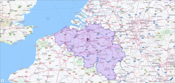
Your search found 1 match. The following is the full list of ACT testing locations in Belgium among which you can pick one to take the exam. Please know that on the test day, test takers can use any 4-function, scientific, or graphing calculator. On the table below, you can also find all test dates through 2019.

2019-2020 ACT Test Dates in Belgium
| Test Date | Registration Deadline |
| February 9, 2019 | January 11, 2019 |
| April 13, 2019 | March 8, 2019 |
| June 8, 2019 | May 3, 2019 |
| July 13, 2019 | June 14, 2019 |
| September 14, 2019 | August 16, 2019 |
| October 26, 2019 | September 20, 2019 |
| December 14, 2019 | November 8, 2019 |
| February 8, 2020 | January 10, 2020 |
| April 4, 2020 | February 28, 2020 |
| June 13, 2020 | May 8, 2020 |
| July 18, 2020 | June 19, 2020 |
ACT Test Centers in Belgium
| City | Center Name | Center Code |
| Brussels | International School of Brussels | 865190 |
More about Belgium
Belgium borders the North Sea in the north-west, the Netherlands in the north, Germany in the east, Luxembourg in the south-east and France in the south and west. The Flemish lowland, Lower Belgium, consists of the up to 30 m high dunes along the only 65.5 km long North Sea coast, a polded marsh border up to 15 km wide as well as deck sand and gravel slabs. This slightly undulating terrain, on average 10–30 m high, which has mostly sandy and in places sandy-loamy soils, reaches heights of up to 100 m above sea level towards the Meuse. Central Belgium is predominantly from Tertiary, in Haspengau hill country built up from layers of chalk, rising from north to south from 80 m above sea level to 200 m above sea level. The watershed between the Scheldt and Maas runs through the fertile loess loam plateaus (Haspengau, Hainaut, Brabant Plateau).
High Belgium begins south of the Maas-Sambre furrow with its coal-bearing seams . It consists of the broad foothills of the Ardennes (Herver Land, Condroz, Famenne, Fagne), the wooded Ardennes, cut by deep valleys, with their extensive high plateaus and the lowland plains of Belgian Lorraine in the south, which leads over to the Paris basin. The highest point in Belgium, the Botrange, is located in the High Fens at 694 m above sea level.
The Paleozoic layers of the Ardennes, parts of the foreland and the Meuse-Sambre furrow were strongly folded in the Variscan mountain formation. The steep strata of Belgian Lorraine reach heights between 300 and 450 m above sea level.
The main rivers are the Meuse, the Scheldt and the Sambre, which are connected by an extensive network of canals. The Albert Canal connects the Meuse near Liège with Antwerp and the Scheldt, the Charleroi-Brussels Canal and the Brussels-Rupel Canal connect the Scheldt with the Sambre.
Population
The Belgian population structure is decisively shaped by the contrasts between Dutch-speaking Flemings (around 59% of the Belgian population) and French-speaking Walloons or Francophones in the Brussels region (around 40%). The cultural and to some extent also economic differences in Belgium were taken into account by creating three regions and three communities (see section State and Society, Administration). 57.5% of Belgians live in Flanders (2016), 32.0% in Wallonia and 10.5% in the Brussels region. On the German-speaking population living in the Eupen area and Sankt Sankt Vith lives, this accounts for only 0.7%. The Flemish-Walloon language border, which has hardly changed since the Middle Ages, runs roughly south of the Menen – Ronse – Geraadsbergen – Halle – Overijsse – Tienen – Tongern – Voeren urban line. Brussels, which has been under French influence since Burgundian times, is a bilingual island (with a predominantly French-speaking part) in the Flemish-speaking area. Although the Flemings have made up the majority of the population since the founding of the Belgian state, the key positions in the state and economy were for a long time predominantly occupied by Walloons. Since the proportion of the Walloon population in relation to the Flemish population has decreased in the last decades, the old Walloon industrial areas are in crisis and the economic focus has shifted to the Flemish part of the country, the Flemings gained considerable influence. The number of foreigners is around 1.2 million (mainly Italians, French, Dutch and Moroccans).
With a population density of 376 residents per km 2 (2017), Belgium is one of the most densely populated countries in the world. More than 10.0% of the total population live in the agglomeration of Brussels, which includes 18 other municipalities in addition to the capital. The areas around Antwerp, Ghent, Mons – Charleroi and Liège are also density centers. The Ardennes are sparsely populated (fewer than 50 residents per km2).
Belgium has long been an urban country in which medieval urbanism flourished more strongly and earlier than in other parts of Central and Western Europe, especially in Flanders and Brabant (Ghent, Bruges, Ypres, Antwerp, Mechelen, Leuven and Brussels).
The biggest cities in Belgium
| Largest cities (inh., As of 2019) | |
| Antwerp | 526,000 |
| Ghent | 262 200 |
| Charleroi | 202 300 |
| Liege | 197 300 |
| Brussels | 181 700 |
The industrialization of the 19th and 20th centuries increased the tendency towards urbanization considerably. After the municipal reform in 1977, the number of independent municipalities fell from 2,359 to 589. The rural settlements in Northern Belgium are mainly single farms or row settlements. The arable landscapes of Haspenau and Hainaut have large clustered villages, while small, densely closed villages predominate in the Ardennes.

