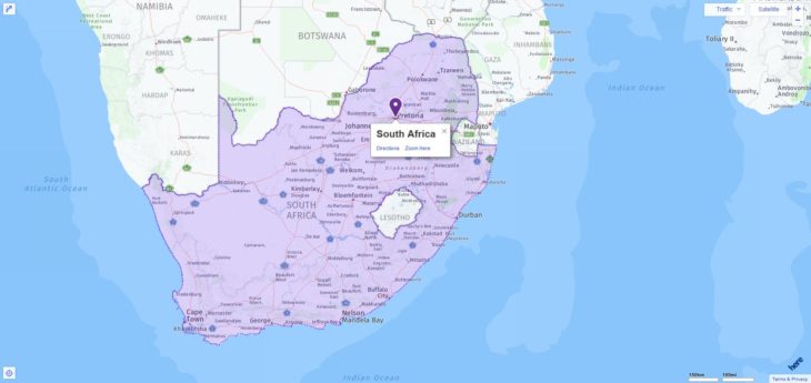
Your search found 3 matches. The following is the full list of ACT testing locations in South Africa among which you can pick one to take the exam. Please know that on the test day, test takers can use any 4-function, scientific, or graphing calculator. On the table below, you can also find all test dates through 2019.

2019-2020 ACT Test Dates in South Africa
| Test Date | Registration Deadline |
| February 9, 2019 | January 11, 2019 |
| April 13, 2019 | March 8, 2019 |
| June 8, 2019 | May 3, 2019 |
| July 13, 2019 | June 14, 2019 |
| September 14, 2019 | August 16, 2019 |
| October 26, 2019 | September 20, 2019 |
| December 14, 2019 | November 8, 2019 |
| February 8, 2020 | January 10, 2020 |
| April 4, 2020 | February 28, 2020 |
| June 13, 2020 | May 8, 2020 |
| July 18, 2020 | June 19, 2020 |
ACT Test Centers in South Africa
| City | Center Name | Center Code |
| Gautengg | American Intl Sch Of Johannesburg | 873640 |
| Johannesburg | African Leadership Academy | 872450 |
| Johannesburg | Witwatersrand University | 869020 |
More about South Africa
South Africa borders in the north with Namibia and Botswana, in the northeast with Zimbabwe, Mozambique and Eswatini, in the east and south with the Indian, in the south and west with the Atlantic Ocean. The Kingdom of Lesotho is surrounded by the national territory.
The Republic of South Africa comprises the southern part of the African continent, bounded to the west by the Atlantic Ocean, to the south and south-east by the Indian Ocean. The 2 798 km long coast, which is only divided by a few bays, is accompanied by two important ocean currents: the warm Agulhas Current from the equator in the east and the cold Benguela Current from the Antarctic in the west. The southernmost point of the country (and the continent) is Cape Agulhas (34 ° 52 ′).
Most of the country is covered by wide flat or undulating plateaus, in the central highlands (Hochveld) 1,200–1,800 m above sea level, in the north-west 900–1,200 m above sea level. They sink in the east of the Northern Cape Province and in the west of the North-West Province gradually northwards to the Kalahari Basin, a largely red-sand dry area with little relief.
In the west, south and east the plateaus are bounded by the Great Edge step, which is most impressive in the Drakensberg. There is also the highest point in the country, the Mafadi at 3,450 m above sea level.
The border area adjoining the coast is occupied in the east by the lowlands (Lowveld) Mpumalangas and the hill country KwaZulu / Natals (Natal Midlands), dominated in the south and west by the Cape chains. An extensive coastal plain with beach lakes can only be found in the northeast. The Orange River, which drains around half of the country to the Atlantic, is used intensively for irrigation, like its largest tributary, the Vaal. The same applies to the Tugela and Limpopo (border rivers in the north), both of which flow into the Indian Ocean, as well as to many smaller, water-rich rivers that break through the Great Edge Step from the highlands.
The Cape Floral protected region combines eight protected areas from the Western Cape and Eastern Cape provinces. Because of its extraordinary abundance of plants ( fynbos ) and the ecological and biological processes that occur here, it has been declared a World Heritage Site by UNESCO.
Geologically, South Africa is part of a very old, stable block of the earth’s crust; The strata found near Barberton (Mpumalanga) are among the oldest known on earth. In the Precambrian, the important deposits of the Witwatersrand (especially gold, uranium), the Buschveld complex (especially platinum, manganese, chromium, vanadium), arose near Phalaborwa (especially copper, phosphate) and the Northern Cape Province (iron, manganese, copper). In the sediments of the Karoo series, which have covered almost two thirds of southern Africa since the middle of the Paleozoic, large coal deposits are found in the Ecca group (Permian). In the Mesozoic (Cretaceous) the kimberlite intrusions formed, to which South Africa owes its diamond wealth (especially in the Kimberley ).
Vegetation
According to the low precipitation, the northwest is mainly occupied by semi-deserts and dry savannas up to the 25th degree of longitude (Richtersfeld, Kalahari, Great Karoo ). Since these arid areas regularly receive fog (near the coast) due to the cold Benguela current on the west coast and mostly rain in winter, a large variety of often endemic succulents could develop here ( ice flowers, with the well-known living stones, milkweed plants, aloe, etc.). In good rainy years, the abundance of flowers in the Namaqualand is one of the most impressive natural spectacles of all.
To the east of this are savannahs of various types. Of from southeast trade influenced south-east coast region is characterized by moist wood subtropical sections. The extreme southwest has a special position. In the winter rainy climate, an extremely species-rich and independent hard-leaf vegetation dominates here. This so-called fynbos has the status of its own flora kingdom ( capensis ). In addition to numerous bulbous plants, heaths with over 650 species and protea plants dominate.

