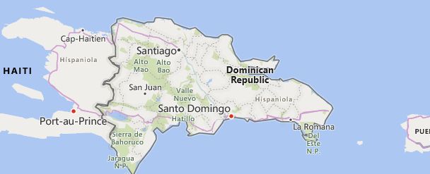
There are 19 high school codes in Dominican Republic today, according to the ACT. The full list is shown below by city, with name of each high school and the city where the school is located (based on the ACT official site). You can search a school code by pressing “Ctrl” + “F” and then type school name or 6-digit school code.
Map of Dominican Republic
High School Codes by City
- High School Code
- 842275
- High School Code
- 842130
- High School Code
- 842222
- High School Code
- 842276
- High School Code
- 842225
- High School Code
- 842175
- High School Code
- 842369
- High School Code
- 842361
- High School Code
- 842362
- High School Code
- 842200
- High School Code
- 842277
- High School Code
- 842368
- High School Code
- 842365
- High School Code
- 842279
- High School Code
- 842278
- High School Code
- 842360
- High School Code
- 842131
- High School Code
- 842274
- High School Code
- 842310
The above lists CEEB codes (College Entrance Examination Board) for all accredited Dominican Republic high schools. Please be informed that the list of high school codes in Dominican Republic may change throughout the year. If you can’t find codes for the high schools of your interest, please write to us or come back at a later time. We will update our database soon after a new high school code is added to the country of Dominican Republic.
Country Abbreviations
DOM is the three-letter country code of Dominican Republic, and DO is the two-letter country code of Dominican Republic. The two-letter suffix is used in top-level domains on the Internet as .do.
Morphology
An accentuated mountainousness characterizes the Dominican territory of Hispaniola, which only towards the East extends into vast plains. The western and central sections present a series of mountainous alignments, longitudinally oriented and roughly parallel to each other, separated by more or less wide valleys. The chains are made up of sedimentary rocks, mostly limestone, from the Cretaceous (late Mesozoic) or Cenozoic; they were bent and fractured by the Cenozoic corrugations, which is also responsible for the presence of conspicuous granite intrusions, while more recent soils, partly alluvial, cover the valleys and other flat areas. The Cordillera Central dominates the country, forming its mountain skeleton (Central Cordillera), considered the orographic node of all the Antilles, to which the reliefs of Puerto Rico are connected on one side, and the Sierra Maestra of Cuba on the other. The Cordillera Central reaches considerable heights (Pico Duarte, highest Antillan elevation, 3175 m; Loma Rusilla, 3029 m) and is engraved by numerous transverse valleys, suitable for human settlement. The chain faces N, beyond the fertile Cibao valley, by the Cordillera Septentrional or Sierra de Monte Cristi, which culminates at 1249 m in the Pico Diego de Ocampo and descends to the N on a high and rocky coast, leaving a small margin to the coastal selvedge. AS of the Cordillera Central, on the other hand, after the San Juan valley, the Sierra de Neiba rises (2262 m), Sierra de Bahoruco: between the two chains opens a deep depression of tectonic origin, which extends into Haitian territory and which is partly occupied by the salt lake of Enriquillo, the surface of which is 46 m below sea level. The eastern section of the Dominican Republic is instead made up of a large flat peninsula, crossed by the Cordillera Oriental (branch of the Cordillera Central), which at no point exceeds 1000 m of altitude. The chain also runs from W to E near the Atlantic coast, leaving ample space in the S for a vast plain which, crossed by numerous rivers, ends on the Sea of the Antilles with low and sandy coasts; the western section of the coastal strip, dominated by the last offshoots of the Cordillera Central, is an area of dense settlement due to the favorable climatic and pedological conditions, also hosting the capital. The coasts, which develop for approx. 1600 km, are very complex. On the northern side opens the vast Escocesa bay, between the heads Francés Viejo and Cabrón, while to the E the bay of Samaná penetrates deeply inland; finally, the southwest coast is rugged by the bays of Ocoa and Neiba. Due to the high temperature of the waters, numerous coral reefs face the coast, while the island formations are few and modest; among these is the flat Beata island in front of the homonymous cape, the extreme southern cusp of the Dominican territory and of the entire island of Hispaniola. while the island formations are few and of modest extension; among these is the flat Beata island in front of the homonymous cape, the extreme southern cusp of the Dominican territory and of the entire island of Hispaniola. while the island formations are few and of modest extension; among these is the flat Beata island in front of the homonymous cape, the extreme southern cusp of the Dominican territory and of the entire island of Hispaniola.

