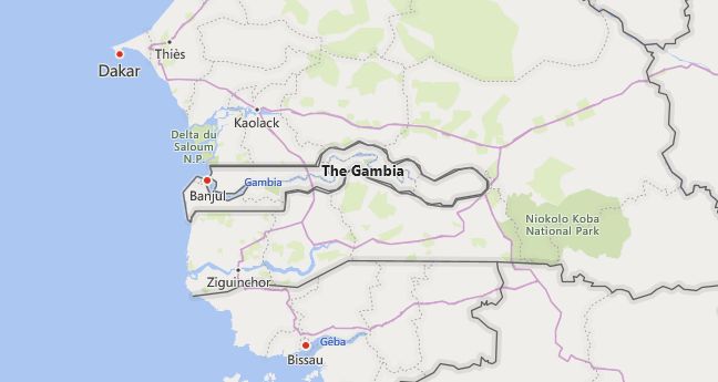
There are 2 high school codes in Gambia today, according to the ACT. The full list is shown below by city, with name of each high school and the city where the school is located (based on the ACT official site). You can search a school code by pressing “Ctrl” + “F” and then type school name or 6-digit school code.
Map of Gambia
High School Codes by City
- High School Code
- 615109
- High School Code
- 615100
The above lists CEEB codes (College Entrance Examination Board) for all accredited Gambia high schools. Please be informed that the list of high school codes in Gambia may change throughout the year. If you can’t find codes for the high schools of your interest, please write to us or come back at a later time. We will update our database soon after a new high school code is added to the country of Gambia.
Country Abbreviations
GMB is the three-letter country code of Gambia, and GM is the two-letter country code of Gambia. The two-letter suffix is used in top-level domains on the Internet as .gm.
Business
With a gross national income (GNI) of (2017) US $ 450 per resident, the Gambia is one of the poorest countries in Africa despite extensive development aid and debt relief. A lack of raw materials, low industrialization, a lack of investment capital and a trained workforce, high population growth and heavily indebted public budgets are the greatest obstacles to economic development. The bases of the economy are agriculture, tourism and fishing.
Foreign trade: The foreign trade balance has been negative for years (import value 2016: 384.3 million US $, export value: 94.0 million US $). In addition to food and crude oil, the main import goods include practically all finished goods as well as machines and vehicles. A large part of the exports are re-exports, as the Gambia, due to its geographical location and the low import duties, also acts as a trading center and intermediary for the countries of Senegal, Guinea and Mali. The most important trading partners are Guinea-Bissau, Senegal, Ivory Coast, Vietnam, Brazil and Spain.
Agriculture
Agriculture, which (2016) contributes 17.8% to the gross domestic product (GDP), employs over two thirds of the labor force. Mostly peanuts for export as well as millet, rice and manioc for personal use are grown in mostly small-scale farms.
Since the country on the edge of the Sahel zone is dependent on strongly fluctuating rainfall, the harvest quantities vary greatly from year to year. Therefore, food has to be imported to supply the population. To improve the nutritional basis, the cultivation of cereals and livestock are promoted through the establishment of breeding farms (especially for cattle).
Fisheries: After peanuts and peanut products, fish and fish products are the country’s main export goods, as both the Gambia River and the Atlantic coast are very rich in fish.
Industry
Industry contributes 13.4% to GDP (2016). The focus of the manufacturing industry is on the processing of peanuts and fish. There are also wood and textile processing companies. The center of industrial production is the area around Banjul.
Tourism
Within the service sector (contribution to GDP: 68.8%) tourism has become an important source of foreign exchange. In order to limit the negative side effects of mass tourism, the Gambian government is specifically promoting sustainable ecotourism. Tourist attractions are in particular the attractive beaches on the Atlantic coast near Banjul, Bakau, Fajara, Kololi and Serrekunda. The river Gambia with its countless side arms is a popular travel destination for ornithologists.
Transportation
The transport network consists of roads and inland waterways; There are no railways or domestic flight connections. An important traffic axis is the asphalt road running south of the Gambia from the capital Banjul on the Atlantic Ocean to Basse Santa Suin the east of the country. A northern axis connects Barra with Kerewan and Farafenni. The road network has a total length of 3,700 km, of which around 700 km are paved. In addition to road connections, the Gambia is the country’s main artery; it can be navigated up to Kuntaur 200 km inland by seagoing vessels with a draft of up to 5 m; for smaller vessels, almost the entire stretch of the river is navigable. So far there are no bridges over the Gambia; it is only crossed by ferries. Sea ports have Banjul and Kau-Ur. Yundum International Airport, 25 km southwest of Banjul, is of great importance for the development of tourist traffic.

